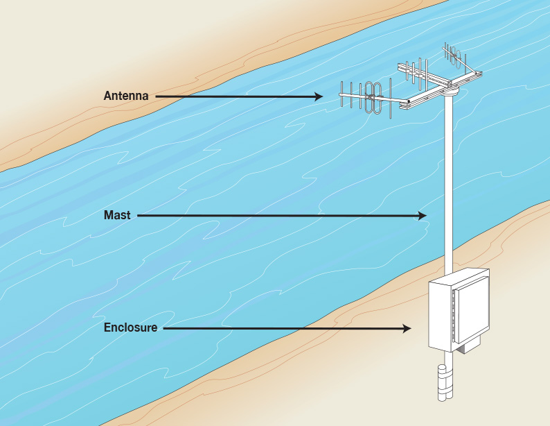
Nothing in the water: a truly non-contact sensor. All hardware is located on the riverbank or on a nearby off-river structure.
Remote
Data retrieval, system monitoring, parameter modifications and even factory support are all conducted through system remote access.
Reliable
All system hardware and software are developed for continuous, long-term field operations, and consistent data outputs.
Low Power
RiverSondes’ low power consumption allow for working off-the-grid with alternative energy sources.
Flexible
Highly flexible software parameters designed to work smoothly, without the need for programming or radar skills.
Cross-Platform
All data products are stored as ASCII files for convenient data transfer to various computer platforms, incorporation into numerical models and GIS programs.
Automated
Data can automatically arrive at your office at your preferred intervals, and can also be sent directly to the Web for public viewing.
Coastal Culture
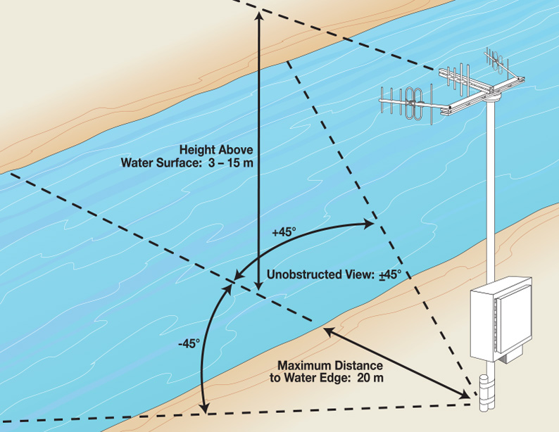
Where visual impact and minimum land-use footprint are all important, nothing beats the RiverSonde ultra-compact design.
Ideal for:
• Continuous, Long-Term Data Sampling
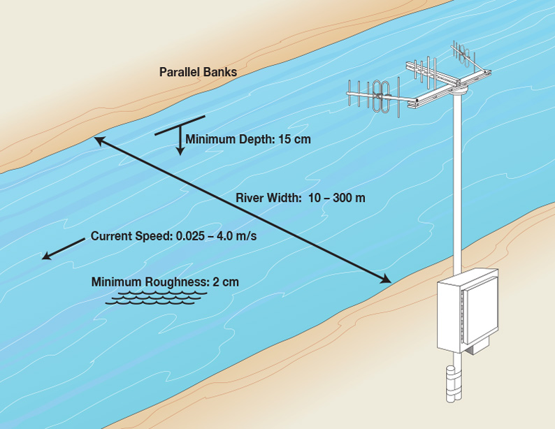
Operates in a wide variety of difficult conditions, such as:
• High Turbidity
• Shallow Bathymetry
• Storms
Ideal for:
• Continuous, Long-Term Data Sampling
Operates in a wide variety of difficult conditions, such as:
• High Turbidity
• Shallow Bathymetry
• Storms
Illustrations for general reference only. Specifications may change.
Please email support@codar.com for any help related to site selection, consultation, or troubleshooting questions. If you are a new user, please specify your institute/organization affiliation when contacting us.